Osaka’s Nakanoshima: Modern and Vibrant
In the 1920s, most of the buildings on Nakanoshima were less than a decade old…
Old Photos of Japan is a community project aiming to a) conserve vintage images, b) create the largest specialized database of Japan’s visual heritage between the 1850s and 1960s, and c) share research. All for free.
If you can afford it, please support Old Photos of Japan so I can build a better online archive, and also have more time for research and writing.
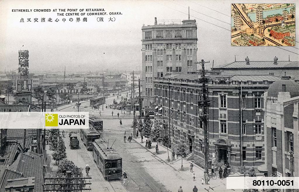
Osaka’s Kitahama business district in the 1920s. New concrete buildings contrast sharply with the nearby wooden architecture. It felt modern and vibrant and was praised as “magnificent urban beauty.”
Introduction
In The Art of Looking Down I briefly introduced Japan’s rich tradition of bird’s-eye view art, highlighting the early 20th-century boom of a new genre: colorful, realistic maps inspired by the rise of aviation and a domestic tourism industry. The article specifically looked at a masterpiece of this genre, the almost impossibly detailed Osaka Panorama Map, published in 1924 (Taishō 13).
In this article, we take a closer look at that map (shown below), zooming in on Nakanoshima, Osaka’s administrative and commercial heart. Pairing select sections of the map with aerial and street-level photos from the same era reveals the creator’s brilliance as well as Osaka’s dramatic transformation.

To better showcase the details, the Nakanoshima section has been divided into three parts. The highlighted area in the center was introduced in Nakanoshima: Small Island, Big Dreams. This article examines the other two sections.
2. Western Nakanoshima
The next map takes us to the western end of Nakanoshima.

Number 2 marks the former site of the Kurume Domain’s kurayashiki, while number 3 was occupied by the Hiroshima Domain. Both were introduced in Nakanoshima: Small Island, Big Dreams.
By 1924, no visible trace of either remained. On the former Hiroshima kurayashiki now stood the Osaka Medical College Hospital, while the former Kurume plot housed the Okura Commercial School. Other schools had been built nearby, making Nakanoshima home to a surprisingly large number of educational institutions. Over twenty according to some sources, although not simultaneously.
This photo shows what the area looked like in 1929. The white building is the Osaka Medical College Hospital, while the smaller u-formed building on the right is the Okura Commercial School.
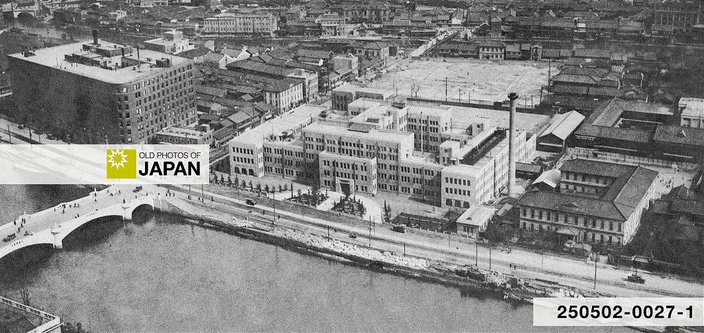
The Osaka Medical College Hospital later became the University of Osaka Hospital. It was moved to Suita in 1993 (Heisei 5). In 2022 (Reiwa 4), the Nakanoshima Museum of Art opened on this spot. Over a mere century and a half, the place went from samurai, to doctors, to artists — from selling rice, to healing the sick, to showcasing art.
Diagonally across from the hospital, the Osaka Central Telegraph Office was later built (below). Completed in 1927 (Showa 2), it was torn down in 1966 (Showa 41).

Note the brand-new Taminobashi Bridge (田蓑橋), built in 1929 (Showa 4). With influences of medieval French Romanesque architecture, it was praised as one of Osaka’s most beautiful bridges. Sadly, it was replaced in 1964 (Showa 39).
The view below, taken from the hospital, shows the bridge better.
One more building in this section of Nakanoshima deserves attention: the Osaka headquarters of the Asahi Shimbun, one of Japan’s largest newspapers.

Hard to imagine today, but the headquarters of Osaka’s two major newspapers, the Asahi and Mainichi, were a source of civic pride and popular tourist attractions. The Asahi head office, in particular, frequently appeared in official photo albums. Vintage postcards featuring the building still surface regularly at auctions.
This section of the Osaka Panorama Map offers a pleasant surprise. While photos suggest that nothing remained of the Edo Period kurayashiki discussed in Osaka's Nakanoshima: Small Island, Big Dreams, the map reveals what appear to be three former funa-iri, the private harbors once located within the kurayashiki compounds. I have marked them with arrows.
Today the RIHGA Royal Hotel Osaka and the Osaka International Convention Center, better known as Grand Cube Osaka, stand on this site.
The Royal was founded in 1935 (Showa 10) as the New Osaka Hotel, located next to the Asahi Shimbun head office (4 and 5 on the map of Western Nakanoshima shown above). For decades, it was regarded as one of the finest hotels in Japan. Alongside the Dōjima Hotel, it stepped into the role held by the Osaka Hotel — also located on Nakanoshima — until a fire destroyed it in 1924.

3. Nakanoshima Park
In 1924, the eastern end of Nakanoshima had just been developed and was home to a large city park and two major bridges: Naniwabashi (1) and Tenjinbashi (6).
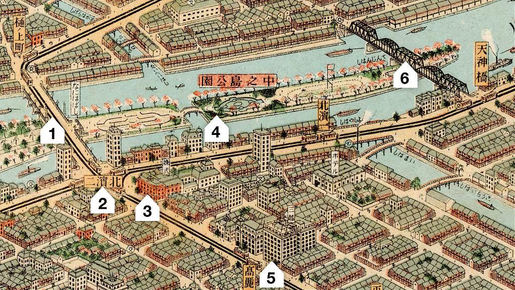
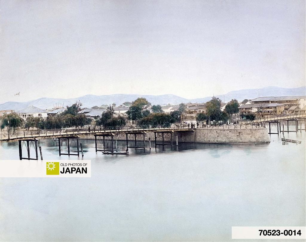
Until 1915 (Taishō 4), Nakanoshima had extended only as far as Naniwabashi; the area between this bridge and Tenjinbashi was still part of the river. The photo below shows Naniwabashi as it looked in the 1880s.
In 1915 (Taishō 4), the area between Naniwabashi and Tenjinbashi was reclaimed to establish a park, which took its final form by 1921 (Taishō 10). The two photos below show the area as it appeared in 1929 (Shōwa 4).
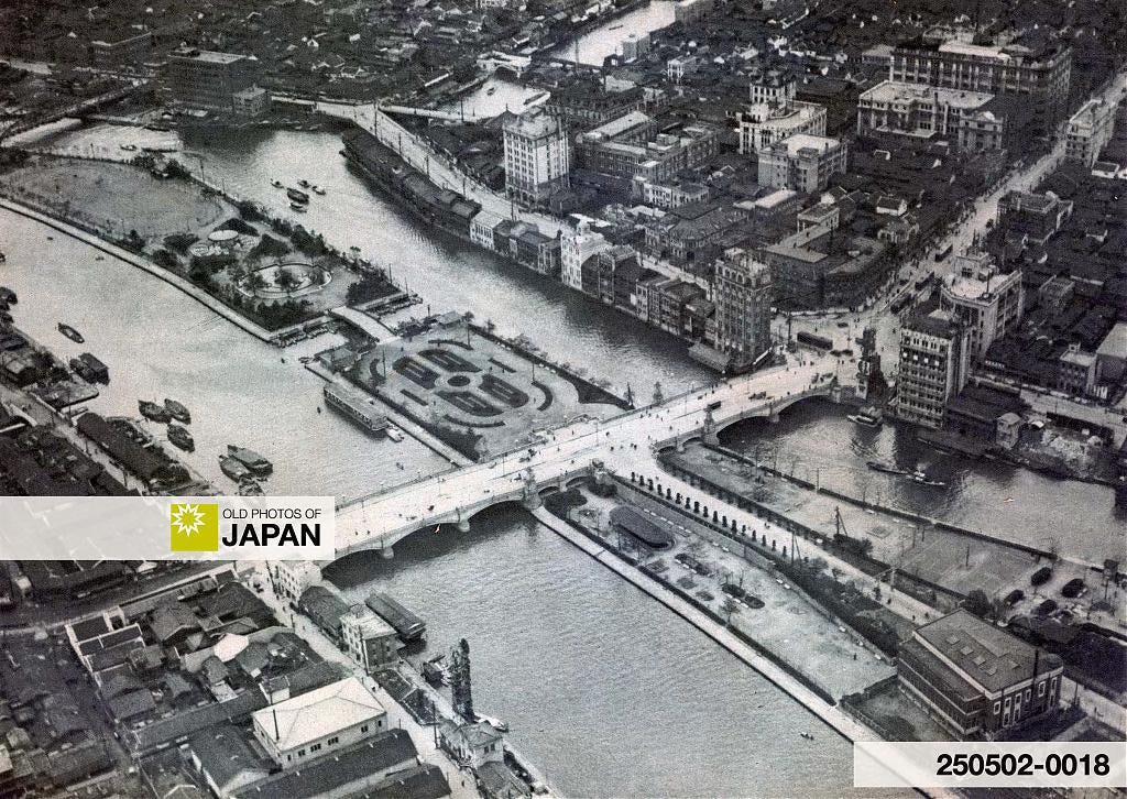
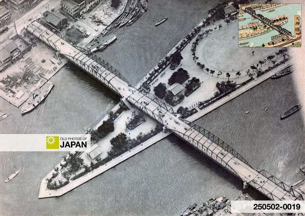
Nakanoshima was now effectively a public space. Central Nakanoshima housed a government district; the western end numerous educational institutions and a hospital; and the eastern end was a public park.
In contrast, the Kitahama area across the river from Nakanoshima Park evolved into Osaka’s main business district. Here stood the Osaka Stock Exchange as well as countless banks and office buildings.
Let’s take a closer look at this area as it looked in the 1920s.
◆ Naniwabashi Bridge
The Naniwabashi Bridge in this postcard was completed in 1915. It was famous for its artistic lampposts and stone statues of lions. The bridge still stands and is one of the oldest Western-style bridges in Japan.
◆ Nakanoshima Park
Nakanoshima Park as seen from Kitahama. Notice the large fountain. This is now a rose garden.
◆ Kitahama Business District
The above view looks from Sakaisuji Avenue towards Naniwabashi, partially visible in the back. The three-story brick building is the Osaka Stock Exchange, completed in 1911 (Meiji 44). In 1935 (Showa 10) a new building replaced it (see further below). That was torn down too, but its iconic entrance remains.
This view shows the same location from the opposite direction. The Osaka Stock Exchange is on the left. The large building in the background is Mitsukoshi Department Store, one of four department stores on Sakaisuji.
The many streetcars on Sakaisuji are silent witnesses to the street’s popularity during this period. However, after Midōsuji Avenue was built in 1937 (Shōwa 12), Sakaisuji lost much of its luster.
The photo below shows the modern stock exchange building completed in 1935.
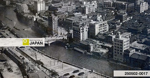
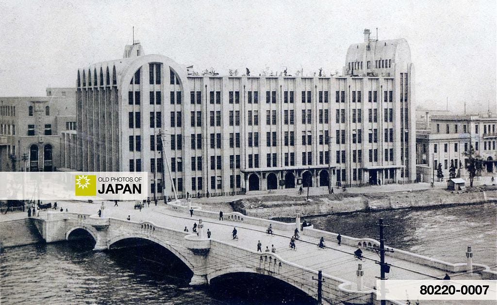
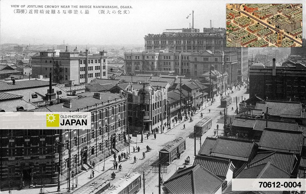
In the next photo, the photographer walked into the street on the left in the above photo, climbed one of the new modern buildings, and aimed the camera back toward the intersection. To the right, Naniwabashi and Nakanoshima are partially visible. The Osaka Court of Appeal’s tower stands out on the right.
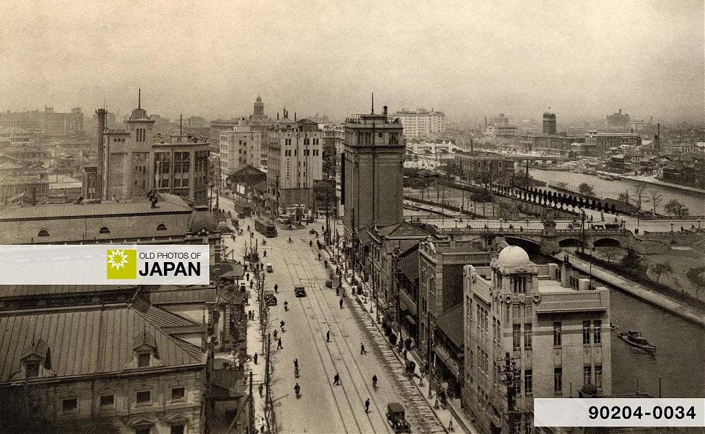
Modern and Vibrant
When the Osaka Panorama Map was published in 1924, most of the buildings on Nakanoshima were less than a decade old and featured Western-style designs. To residents at the time, the area felt strikingly modern and vibrant.
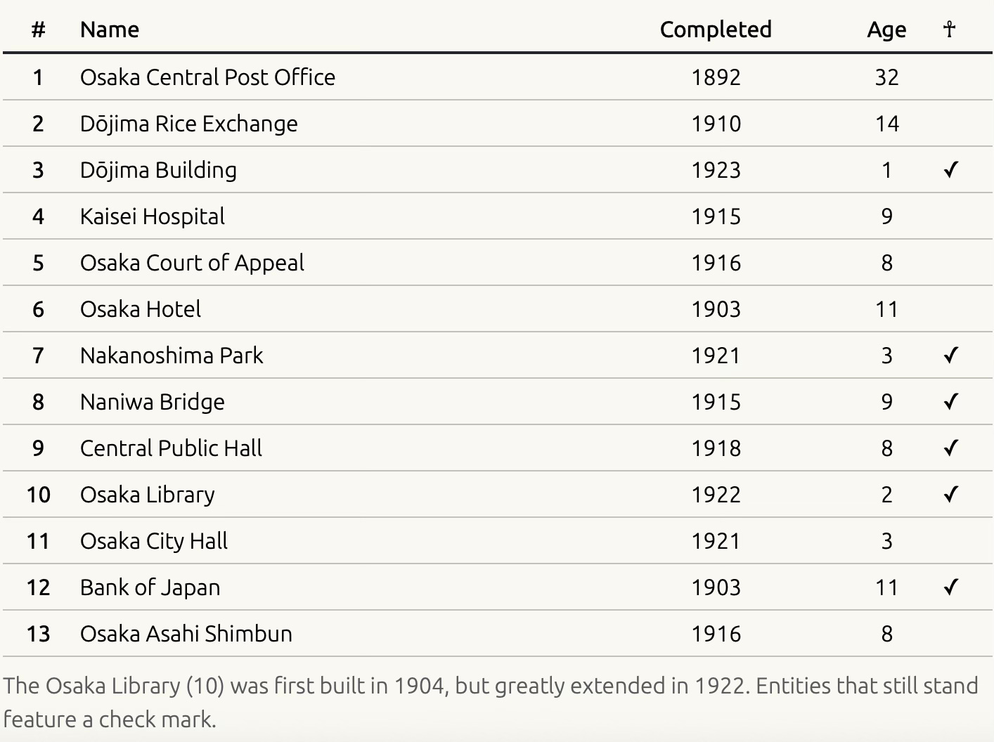
To illustrate this bold modernity, the map, table, and photo below show the completion dates of major structures on and around Nakanoshima. The table also displays each structure’s age in 1924, and whether it still stands (marked ✓).
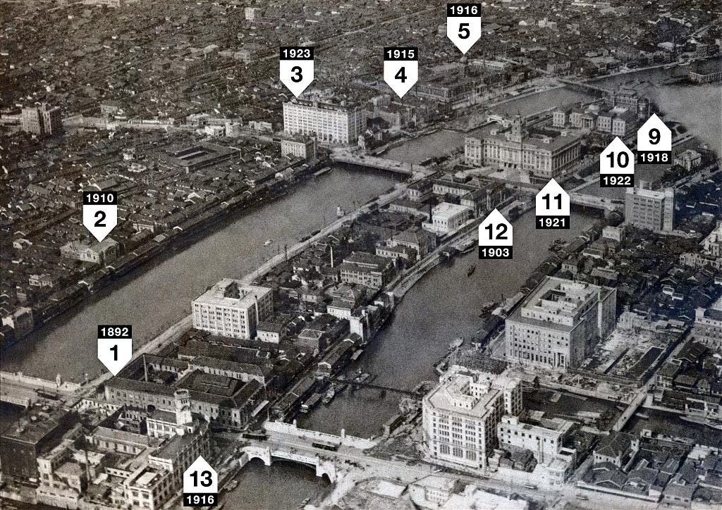
Over the past few decades, Nakanoshima has transformed once again. The area is now defined by skyscrapers and elevated highways. However, the public role first established in the 1920s endures — Nakanoshima is home to five major museums, while Nakanoshima Park has been given a new lease on life by an ongoing urban regeneration project focusing on Osaka’s waterways.1
✪ Nakanoshima Museums
Osaka Science Museum (1989)
Nakanoshima Museum of Art, Osaka (NAKKA) (2022)
National Museum of Art, Osaka (1977)
Nakanoshima Kosetsu Museum (2018)
The Museum of Oriental Ceramics, Osaka (1982)
The next two photos show the western tip of Nakanoshima in 2006 and the 1890s.

The following museums are not located on Nakanoshima, but introduce Osaka’s history. One displays a replica of the Osaka Panorama Map used in this essay.
✪ Osaka History Museums
Osaka Museum of Housing and Living — The 8th floor features a huge replica of the Osaka Panorama Map
Osaka Museum of History — A beautiful diorama of the Hiroshima kurayashiki on Nakanoshima can be found on the 9th floor
Museum of Commercial History, Osaka University of Commerce — Introduces the culture of Edo Period Osaka merchants
Japan Folk Crafts Museum, Osaka — Not really a museum of Osaka history, and a bit out of the way, but nonetheless highly recommended
The article on the Old Photos of Japan site features links for all museums.
Notes
The Aqua Metropolis Osaka Plan was first initiated in 2001 (Heisei 13). For more information, visit the site of Suido Osaka Consortium.








Thank you for this fascinating showcase! I happened to visit Nakanoshima just last year, wandering through Kosetsu Art Museum & staying at a hotel in the area. Maybe I should've taken a peek at Naniwabashi too.
I love the Asahi Shinbun headquarters building too! Kosetsu Museum has a (permanent?) exhibition about Maruyama Ryoichi, who founded the Asahi in Osaka. Apparently he was also an art collector & tea practitioner, who built his own tea room. If you haven't been yet, I can recommend it!
Looking at the photo of the Osaka Medical College Hospital and the Okura Commercial School, there's a big square building to the left of the hospital. Is that the Daibiru ( ダイビル本館 ) ?
When we when to the Nakanoshima Museum of Art last year we walked through that building and looking back saw that it now seems to be a skyscraper which has kept the facade of an older building that was there before. Google maps ( https://maps.app.goo.gl/j8M5rH5MiSZHH7Lt8 ) has a nice collection of pictures of it